SCIENTIFIC CURRICULUM VITAE
- Personal details
|
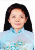
Full name: Huynh Thi Thu Huong |
Gender (M/F): F |
|
Date of birth: January 26th, 1972 |
|
|
Educational degree (PhD, MSc): PhD |
Year obtained: 2017 |
|
Title (Prof., Assoc. Prof., etc): |
Year confered: |
|
Position: Lecturer |
Year confered: 2008 |
|
Institution & Department: Department of Land Resources, College of Environment and Natural Resources, Can Tho University, Vietnam Address: 3/2 Street, Can Tho City, Vietnam Mobile phone: 84-946-150275 E-mail: htthuong@ctu.edu.vn |
|
|
Home address: 61, B13 street, An Khanh Ward, Ninh Kieu District, Can Tho City, Vietnam Tel.: |
|
II. Qualifications (training)
Years |
Academic institutions |
Major/Specialty |
Academic degree |
|
2017 |
Can Tho University, College of Agriculture and Applied Biology, Department of Soil Science and Land Management |
Land and water environment |
PhD |
|
2007 |
Can Tho University, College of Agriculture and Applied Biology, Department of Soil Science and Land Management |
Agronomy |
MSc |
|
1996 |
Can Tho University, Vietnam, College of Cultivation. |
Cultivation |
BSc |
* Language (rating: A- Poor/ deficient; B- Fair; C- Sufficient; D- Fluent)
|
Language |
Reading |
Writing |
Speaking |
|
English |
B |
B |
B |
III. Professional working experience
Years (from ... to ...) |
Institution and address |
Position and Responsibilities |
|
01/2011 - present |
Can Tho University, Vietnam, College of the Environment and Natural Resources, Department of Land Resources. |
Lecturer in the field of GIS and remote sensing
|
|
12/2008 - 12/2010 |
Can Tho University, Vietnam, College of Agriculture and Applied Biology, Department of Land Resources. |
Lecturer in the field of GIS and remote sensing
|
|
01/1999 - 11/2008 |
Can Tho University, Vietnam, College of Agriculture and Applied Biology, Department of Soil Science and Land Management |
Teaching assistant in the field of GIS and remote sensing |
|
01/1997 - 12/1998 |
Can Tho University, Vietnam, College of Agriculture and Applied Biology, Department of Soil Science and Land Management |
Researcher in the field of GIS and remote sensing |
- Expertise and research interests
- Research projects/programs participating or leading relevant to the field of study
|
No. |
Project/program title |
Duration (from… to…) |
Category (national, ministerial, institutional, Int'l collaborative) |
Position/role in the project (principal or member) |
|
1 |
Using multi temporal radar image for flooding management and land use change of Mekong Delta (Cooperate with IRRI). |
2000 |
Institutional collaborative |
Member |
|
2 |
Capacity of sediment on rice growth and applying spot image low resolution for sediment deposited evaluation in An Giang province (Vlir project) |
2007 |
Institutional collaborative |
Member |
|
3 |
Using multi spectral and temporal image for landuse change in coastal zone of Mekong Delta |
2007 |
Ministerial collaborative
|
Member |
|
4 |
To evaluate the potential fertility and constrain elements of rice and fruit land of Hau Giang province |
2009 |
Provincial collaborative |
Member |
|
5 |
Evaluation and landuse planning in Cu Lao Dung district, Soc Trang province. |
2004 |
Provincial collaborative |
Member |
|
6 |
Assess the role of sediment deposition on rice land and application of remote sensing to monitor the distribution of sediment in An Giang province –VLIR project |
2007 |
Institutional collaborative |
Member |
|
7 |
Using multispectral anfd temporal remote sensing images to monitor the restructuring of aquaculture on coastal mangrove areas in the Mekong Delta |
2007 |
Ministerial collaborative
|
Member |
|
8 |
Assessment of potential fertility and constraint factors on orchard and rice soil in Hau Giang Province |
2009 |
Provincial collaborative |
Member |
|
9 |
Monitoring Applications MODIS imagery to Monitor land surface temperature changes and droughts in the Mekong Delta under the global climate change |
2011 |
Institutional collaborative |
Member |
|
10 |
Web GIS technology and application of remote sensing image management sowing progress and warning pest of rice in An Giang province. |
2010-2013 |
Provincial collaborative |
Member |
|
11 |
Monitoring and management the trend of urban vegetation in Can Tho City towards sustainable security |
2013 |
Institutional collaborative |
Principal |
|
12 |
Monitoring the flood effecting on rice crop in Mekong Delta using remote sensing technique |
2014 |
Institutional collaborative |
Principal |
- Training Workshop/Certificate:
- Certificate: “Digital Image Processing for Environmental Management – A Remote Sensing Perspective” conducted by Indian Institute of Remote Sensing (IIRS), Dehra Dun, India. From August 30, 1999 to September 24, 1999.
- Certificate: “Remote Sensing and Geographic Information Systems for Coastal Zone Management” conducted by National Space Agency of Japan (NASDA) Remote Sensing Technological Center of Japan (RESTEC). From June 24, 2002 to July 5, 2002 at AIT, Bangkok, Thailand
- Certificate: “GIS and Remote Sensing course (Special program)”, conducted by AITCV, HCM city, Vietnam. From September 29 to Octorber 12, 2004.
- Certificate: “2010 Capacity Building Workshop of Satellite Remote Sensing for Southeast Asian Scientists” conducted by Center for Space and Remote Sensing Research, National Central University, Jhongli, Taiwan. From September 27 to October 5, 2010.
- Certificate: “2012 The International School on Atmospheric Radar - National Central University (ISAR-NCU)” conducted by Center for Space and Remote Sensing Research, National Central University, Jhongli, Taiwan. From November 12 to November 17, 2012.
- Certificate: “Monitoring the Progress of Flood-Affecting Rice Cropping in the Mekong Delta Using MODIS Satellite Image” conducted by Space Center of Germany. From March 5 to March 7, 2013
- List of publications (listed as reference format)
- Vo Quang Minh, Pham Van Quang, Nguyen Thi Hong Diep, Huynh Thi Thu Huong, Tran Van Hung, Tran thi ngoc Trinh and Nguyen Van Phu. 2001. Geographic Information System GIS in land use planning, Environment, Natural resource management – Development Strategy. Paper presented in 2001, Annual report. Cantho University. Cantho, Vietnam.
- Vo Quang Minh, Nguyen Thi Hong Điep, Huynh Thi Thu Huong, Lê Quang Tri, Nguyen Thanh Phuong and Nguyen Đang Phuong. 2006. Identify and delineate the changing of land uses in the coastal zone of Camau peninsula, Vietnam by using SPOT satellite images. Paper presented in 2006, Annual report. Cantho University. Cantho, Vietnam.
- Vo Quang Minh, Vo Thi Gương, Nguyen Thi Hong Điep, Huynh Thi Thu Huong and Tran Van Hung, 2009. Application of SPOT quicklook satellite images to identify changing of foret in Vo Doi Region, U Minh Ha National Park , Ca Mau Province. Conservation of mangrove forest and peat land area of U Minh Ha - Ca Mau, editor: Assoc. Pro. Vo Thi Agriculture Publishing. 63-634.9/NN-09 04/49-09. Pages 114-123.
- Huynh Thi Thu Huong, Tran Thi Hien and Vo Quang Minh, 2010. Monitoring the progress of sowing and establishment of the landuse map of the rice crop in Mekong Delta - using MODIS satellite images. Paper presented in 2010, Annual report. Cantho University. Cantho, Vietnam.
- Huynh Thi Thu Huong, Truong Chi Quang, Tran Thanh Dan. 2012. Application the MODIS images to monitor the change of land surface temperature and drought situation in the Mekong Delta. Journal of Can Tho University. No. 24a/2012. Pages 49-59. ISSN 1859-2333.
- Huynh Thi Thu Huong, Vo Quang Minh, Bui Thi Nga, 2012. “Distributions and volumes of mangrove forests in coastal areas, Baclieu province”. Journal of Agriculture and Rural Development, No. 14/2012. Ministry of Agriculture and Rural Development, Vietnam. Agriculture Pages 88-93.
- Vo Quang Minh, Huynh Thi Thu Huong, Nguyen Thi Hong Diep, 2012. “Monitoring and delineating rice cropping calendar in the Mekong Delta using MODIS image”. Proceeding of International Symposium on GeoInformatics for Spatial-Infrastructure Development in Earth and Allied Sciences, No. 10/2012. Vietnam National University- Ho Chi Minh City Publishing House, Page 150-156.
- Nguyen Hong Quyen, Huynh Thi Thu Huong, Vo Quang Minh, 2012. “Application of MODIS imagery for drought impact monitoring on agriculture in the Mekong Delta”. Proceedings of the National Workshop on Application of GIS in 2012. Agricultural Publishing House. Page 16-24.
- Nguyen Quoc Hau, Huynh Thi Thu Huong, Vo Quang Minh, 2012. “Asessment of the MODIS data ability in monitoring land use change on provincial and district level – Case study in Vinh Long Province”. Proceedings of the National Workshop on Application of GIS in 2012. Agricultural Publishing House. Page 111-117.
- Huynh Thi Thu Huong, Vo Quang Minh, Ho Van Chien. 2013. Monitoring the progress of rice sowing/transplanting and cropping calendar for early warning rice pests in the Mekong River Delta based on remote sensing images. National workshop on GIS applications in 2013. Agriculture University Publishing. Pages 128-139. ISBN 978-604-924-039-3
- Huynh Thi Thu Huong,Vo Quang Minh, Le Anh Tuan. 2016. Using remote sensing MODIS data for monitoring the effects of drought and flood on rice farming system changes in the Vietnamese Mekong Delta. Journal of Can Tho University No. 45a/2016. Pages 52-65. ISSN 1859-2333
SCIENTIFIC CURRICULUM VITAE
- Personal details
|
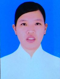
Full name: Nguyen Thi Hong Diep |
Gender (M/F): F |
|
Date of birth: 14-07-1971 |
|
|
Educational degree (PhD, MSc): PhD |
Year obtained: 2014 |
|
Title (Prof., Assoc. Prof., etc): |
Year confered: |
|
Position: Lecturer |
Year confered: 2004 |
|
Institution & Department: Department of Land Resources, College of Environment and Natural Resources, Can Tho University, Vietnam Address: 3/2 Street, Can Tho City, Vietnam Mobile phone: 84-946-150275 E-mail: nthdiep@ctu.edu.vn |
|
|
Home address: 148/115, Hung Loi Ward, Ninh Kieu District, Can Tho City, Vietnam Tel.: |
|
II. Qualifications (training)
Years |
Academic institutions |
Major/Specialty |
Academic degree |
|
2014 |
Asian Institute of Technology (AIT), Thailand |
Remote Sensing & GIS |
PhD |
|
2005 |
Can Tho University, College of Agriculture and Applied Biology, Department of Environmental Science |
Environmental Science and Management |
MSc |
|
1994 |
Can Tho University, Vietnam, College of Aquaculture. |
Aquaculture |
BSc |
* Language (rating: A- Poor/ deficient; B- Fair; C- Sufficient; D- Fluent)
|
Language |
Reading |
Writing |
Speaking |
|
English |
C |
C |
C |
|
|
|
|
|
III. Professional working experience
Years (from ... to ...) |
Institution and address |
Position and Responsibilities |
|
2014 – present |
Can Tho University, Vietnam, Lecturer and Researcher in Department of Land Resources. |
Research in the field of Remote sensing and GIS, coastal resources, ecosystem service and environment management. |
|
2009 - 2014 |
Asian Institute of Technology (AIT), Thailand |
PhD researcher. Research in the field of coastal ecology, carrying capacity and site suitability assessment for aquaculture using geospatial analysis. |
|
2004 - 2009 |
Can Tho University, Vietnam, College of Agriculture and Applied Biology, Department of Soil Science and Land Management |
Lecturer in the field of remote sensing and GIS, Geostatistic in Environment, Coastal Management, Environmental Impact Assessment. Supervision of undergraduate students in the field of remote sensing applications, GIS, land management, environment assessment |
|
1991 – 2004 |
Can Tho University, Vietnam, College of Agriculture and Applied Biology, Department of Soil Science and Land Management |
Teaching assistant in the field of GIS |
|
1996 – 1999 |
Can Tho University, Vietnam, College of Agriculture and Applied Biology, Department of Soil Science and Land Management |
Researcher in the field of GIS |
- Expertise and research interests
|
1. Research projects/programs participating or leading relevant to the field of study |
|||
|
Project/program title |
Duration (from… to…) |
Category (national, ministerial, institutional, Int'l collaborative) |
Position/role in the project (principal or member) |
|
Applied the Low resolution Remote Sensing to determine the distribution and biomass estimation on the coastal mangrove species in Mekong Delta, Vietnam |
2015-2016 |
Institutional collaborative |
Principal |
|
Impact Assessment of Climate Change on Aquaculture/ Fisheries Household Livelihood in the Lower Mekong Delta, Vietnam |
2015-2016 |
Int'l collaborative |
Principal |
|
Assessing the Fertile Potential and Obstacles Factors on Cultivated Soil of Rice and Fruit Trees in Hau Giang Province |
2008-2009 |
Provincial collaborative |
Member |
|
Application of GIS technology to develop data management system for assessing state and warned of agricultural pests in the Mekong Delta |
2005-2008 |
Provincial collaborative |
Member |
|
Assessments the Society and Economics in Hau Giang Province |
2005-2007 |
Provincial collaborative |
Member |
|
Assessment methods arsenic contaminated distribution (As) in groundwater using GIS techniques |
2004-2005 |
Institutional collaborative |
Principal |
|
Developing database management system for management and assessment of environmental resources in Soc Trang province |
2002-2004 |
Provincial collaborative |
Member |
- List of publications (listed as reference format)
- a) Book chapters
- b) Articles
- Q Minh, V.T. Anh, M. Tromp, P.T.T. Hoa, N.T.H Diep, and D.V Tho. 1998. Mekong Delta Mangrove forest changes over the last 5 year by means of remote sensing. Proceeding of an International Workshop on “the rehabilitation of degraded coastal systems”. Phuket Marine Biological Center. Department of Fisheries Phuket-Thailand. 19-24 Jan 1998. pages : 69- 72
- Vo Quang Minh, Pham Van Quang, Nguyen Thi Hong Diep, Huynh Thi Thu Huong, Tran Van Hung, Tran Thi Ngoc Trinh, Nguyen Van Phu. Geographic Information System GIS in land use planning, Environment, Natural resource management – Development Strategy. Paper presented in 2001 Annual report. Cantho University. Cantho, Vietnam
- Vo Quang Minh. Nguyen Thi Hong Diep. Application of SPOT quicklook satellite images to identify and delineate the changing of land uses in the coastal zone of Camau peninsula, Vietnam. Procecding ACRS2005, The 26th Asian conference on remote sensing. 7-11 November 2005. Hanoi, Vietnam.
- Vo Quang Minh, Nguyen Thi Hong Diep, Vo Thi Guong. 2007. Using remote sensing for evaluating the change of peat swamp forest in the Mekong delta, Vietnam. In: Proceedings of the International Symposium and Workshop on Tropical Peatland, Yogyakarta, 27-29 August 2007-Carbon-climate-human interactions on tropical peatland: carbon pools, fire, mitigation, restoration and wise use. ISBN 978-1-870474-34-4. Department of Geography, University of Leicester, United Kingdom
- Phan Kieu Diem, Nguyen Thi Hong Diep, Vo Quang Minh. 2010. The statement of calamity and disaster in mekong delta, Vietnam. 3rd International Conference on Geoinformation Technology for Natural Disaster Managerment and Rehabilitation, 19-20 October 2010, The Empress Hotel, Chaingmai, Thailan.
- Vo Quang Minh, Huynh Thi Thu Huong, Nguyen Thi Hong Diep. 2012. Monitoring and Delineating Rice Cropping Calendar in the Mekong delta Using MODIS images. Proceedings of International Symposium on GeoInformatics for Spatial-Infrastructure Development in Earth and Allied Sciences. Pages 150-156. Hochiming City, Vietnam, 16-20 October, 2012.
- Nguyen Thi Hong Diep, Nitin Kumar Tripathi, Wenresti G. Gallardo and Taravudh Tipdecho. 2013. Coastal Ecology Changes and Aquaculture Management in Phu Quoc Island, Vietnam (2006-2011). Proceedings of International Symposium on GeoInformatics for Spatial-Infrastructure Development in Earth and Allied Sciences. Pages 193-198. Hochiminh City, Vietnam, 16-20 October, 2012.
- Nguyen Thi Hong Diep; Wenresti Glino Gallardo; Nitin Kumar Tripathi; Truong Hoang Minh. 2013. Cobia cage culture distribution mapping and carrying capacity assessment in Phu Quoc, Kien Giang province. Journal of Vietnamese Environment, 2013, Vol. 4, No. 1, pp. 12-19. ISSN 2193-6471
- Phan Kieu Diem, Vo Quang Minh, Nguyen Thi Hong Diep, Duong Thanh Thoai. 2013. Monitoring the shoreline change Ngoc Hien district, Ca Mau Province from 1995 to 2010 by using remote sensing and GIS. Proceeding 9thInternational conference on Gi4DM 2013, Earth observation for disaster management. Hanoi, Vietnam from 9-11 December, 2013. Số tạp chí ISBN: 978-604-913-173-8(2013), TS08-3 page 1-10
- Nguyen Thi Hong Diep, Nitin Kumar Tripathi, Wenresti G. Gallardo and Vo Quang Minh, 2013. Carrying capacity and site suitability assessment for Cobia fish culure in the Northern part of Phu quoc Island, Vietnam. Proceeding 9thInternational conference on Gi4DM 2013, Earth observation for disaster management. Hanoi, Vietnam from 9-11 December, 2013. ISBN: 978-604-913-173-8(2013), TS05-4, page 1-10
- Nguyen Thi Hong Diep, Nitin Kumar Tripathi, Wenresti G. Gallardo & Taravudh Tipdecho. Coastal and marine ecological changes and fish cage culture development in Phu Quoc, Vietnam (2001 to 2011). Journal of Geocarto International. Volume 29, 2014 - Issue 5, page 486 – 506. ISSN 1010-6049.
- Phan Kieu Diem, Vo Quang Minh, Nguyen Thị Hong Diep. Assessment trend of inundation and salinity intrusion in coastal zone, Mekong Delta through climate change scenarios. The 36th Asian conference on Remote Sensing. October 19-23, 2015. Manila, Philippine.
- Nguyen Thi Hong Diep, Vo Quang Minh, Phan Kieu Diem. Assessment of the vulnerable area of climate change impacts on coastal region of Mekong Delta using geographic information system technique. The 36th Asian conference on Remote Sensing. October 19-23, 2015. Manila, Philippine. ISBN:9781510817210
- Ho Huu Loc, Nguyen Thi Hong Diep, Nguyen Trong Can, Kim N. Irvine,
Yoshihisa Shimizu. 2017. Integrated evaluation of Ecosystem Services in Prawn-Rice rotational crops, Vietnam. Ecosystem Services Journal. April 2016. http://dx.doi.org/10.1016/j.ecoser .2016.04.007. 2212-0416/& 2016 Elsevier B.V. Volume 26, Part B, August 2017, Pages 377-387. - Ho Huu Loc, Kim N. Irvine, Nguyen Thi Hong Diep, Nguyen Thi Kim Quyen,
Nguyen Ngoc Tue, Yoshihisa Shimizu. 2016. The legal aspects of Ecosystem Services in agricultural land pricing, some implications from a case study in Vietnam's Mekong Delta. Ecosystem Services Journal. http://dx.doi.org/10.1016/j.ecoser.2016.11.019. 2212-0416/ © 2016 Elsevier B.V. Article in press. - Nguyen Trong Can, Nguyen Thi Hong Diep, and Ho Huu Loc. 2016. “Exploratory Assessment of Prawn-Rice Rotational Crops Spatial Distribution and Ecosystem Services Values.” In The 37th Asian Conference on Remote Sensing. “Promoting Spatial Data Infrastructure for Sustainable Economic Development.” in Sri Lanka. pp 301-350.
SCIENTIFIC CURRICULUM VITAE
- Personal details
|
Full name: Vo Quoc Tuan |
Gender (M/F): M |
|
Date of birth: 28-02-1978 |
|
|
Educational degree (PhD, MSc): PhD |
Year obtained: 2013 |
|
Title (Prof., Assoc. Prof., etc): |
Year confered: |
|
Position: Head of GIS and Remote Sensing Lab |
Year confered: 2013 |
|
Institution & Department: Department of Land Resources, College of Environment and Natural Resources, Can Tho University, Vietnam Address: 3/2 Street, Can Tho City, Vietnam Mobile phone: 84-913-604111 E-mail: vqtuan@ctu.edu.vn |
|
|
Home address: 263D/7, An Binh Ward, Ninh Kieu District, Can Tho City, Vietnam Tel.: |
|
II. Qualifications (training)
Years |
Academic institutions |
Major/Specialty |
Academic degree |
|
2013 |
German Aerospace Center, Germany |
Remote Sensing |
PhD |
|
2008 |
Seoul National University, South Korea, Department of Agricultural Economics and Rural Development, Regional Information Major |
Economics |
MSc |
|
2001 |
Can Tho University, Vietnam, College of Agriculture and Applied Biology, Department of Soil Science and Land Management |
Land Management |
BSc |
* Language (rating: A- Poor/ deficient; B- Fair; C- Sufficient; D- Fluent)
|
Language |
Reading |
Writing |
Speaking |
|
English |
C |
C |
C |
|
|
|
|
|
III. Professional working experience
Years (from ... to ...) |
Institution and address |
Position and Responsibilities |
|
06/2013 – Present |
Can Tho University, Vietnam, Lecturer and Researcher in Department of Land Resources. |
Research in the field of Remote sensing, Ecosystem service valuation and Environmental economics |
|
08/2009 – 05/2013 |
German Remote Sensing Data Center, DLR, Germany |
PhD researcher. Research in the field of economic evaluation of mangrove ecosystem services using combined approaches of remote sensing data and socio-economic data. |
|
03/2008 - 07/2008 |
Can Tho University, Vietnam, College of Agriculture and Applied Biology, Department of Soil Science and Land Management |
Researcher in the field of remote sensing and cadastral mapping; Supervision of undergraduate students in the field of remote sensing applications, GIS, land management, environment assessment and cadastral mapping |
|
02/2006 – 02/2008 |
Seoul National University, South Korea |
Department of Agricultural Economics and Rural Development, Regional Information Major; Master of Art in Economics. |
|
10/2001 – 02/2006 |
Can Tho University, Vietnam, College of Agriculture and Applied Biology, Department of Soil Science and Land Management |
Researcher and Teaching assistance in the field of GIS and Remote Sensing |
|
09/1997 – 09/2001 |
Can Tho University, Vietnam, College of Agriculture and Applied Biology, Department of Soil Science and Land Management |
Bachelor of Land Management. |
- Expertise and research interests
|
1. Research projects/programs participating or leading relevant to the field of study |
|||
|
Project/program title |
Duration (from … to …) |
Category (national, ministerial, institutional, Int'l collaborative) |
Position/role in the project (principal or member) |
|
Mangrove ecosystem services valuation-a combined approach of remote sensing and household survey analyses |
2013-2014 |
Int'l collaborative |
Principal |
|
Remote sensing-based Information and Insurance for Crops in Emerging economies (“RIICE”) |
2015-2017 |
Int'l collaborative |
Member |
|
|
2016-2017 |
|
|
|
Ecosystem-Based Coastal Spatial Planning Demonstration Project in Ca Mau province, Viet Nam |
|
Int'l collaborative |
Principal |
- List of publications (listed as reference format)
- a) Book chapters
- b) Articles in peer-reviewed journals
Hironori Arai, Ryo Yoshioka, Syunsuke Hanazawa, Vo Quang Minh, Vo Quoc Tuan, Tran Kim Tinh, Truong Quoc Phu, Chandra Shekhar Jha, Suraj Reddy Rodda, Vinay Kumar Dadhwal, Masayoshi Mano, and Kazuyuki Inubushi, 2016 Function of the methanogenic community in mangrove soils as influenced by the chemical properties of the hydrosphere. Soil Science and Plant Nutrition. Vol. 62, http://dx.doi.org/10.1080/00380768.2016.1165598
Tuan Quoc Vo, C. Kuenzer, N. Oppelt, 2015. How remote sensing supports mangrove ecosystem service valuation: A case study in Ca Mau province, Vietnam. Ecosystem Services. Volume 14, August 2015, Pages 67-75, ISSN 2212-0416, http://dx.doi.org/10.1016/j.ecoser.2015.04.007.
QT Vo., OPPELT, N., and C. KUENZER, 2013: Remote Sensing in Mapping Mangrove Ecosystems - An Object-based Approach Remote Sensing 5(1), 183-201. doi:10.3390/rs5010183
QT Vo, C Kuenzer, QM Vo, F Moder, N Oppelt, 2012: Review of valuation methods for mangrove ecosystem services. Ecological Indicators 23, 431-446. doi:10.1016/j.ecolind.2012.04.022
KUENZER, C., CAMPBELL, I., ROCH, M., LEINENKUGEL, L., VO QUOC, T., and S. DECH, 2012: Understanding the Impacts of Hydropower Development in the context of Upstream-Downstream Relations in the Mekong River Basin. Sustainability Science. http://dx.doi.org/10.1007/s11625-014-0275-3
J Huth, C Kuenzer, T Wehrmann, S Gebhardt, QT Vo, S Dech, 2012: Land cover and land use classification with TWOPAC: towards automated processing for pixel-and object-based image classification. Remote Sensing 4 (9), 2530-2553. doi:10.3390/rs4092530
Claudia Kuenzer, Andrea Bluemel, Steffen Gebhardt, Tuan Vo Quoc and S. Dech, 2011: Remote Sensing of Mangrove Ecosystems- A review. Remote Sensing 3 (5), 878-928. doi:10.3390/rs3050878
- Other information
- Research gate: (by 30-05-2017)
Score: 20.05; Citation: 586
- Reviewer for journals: Ecosystem services, Remote Sensing, Forest
SCIENTIFIC CURRICULUM VITAE

- Name: Pham Thanh Vu
- Date of birth: April 21th, 1977
- Nationality: Vietnamese
- Name of firm: Department of Land Resources, College of Environment and Natural Resources, Can Tho University
- Current positions: Department Vice-Head
- Academic qualification:
- in Land Management, Can Tho University, Viet Nam (1999);
- in Soil Sciences, Can Tho University (2007);
- D. study in Land and Water Environment, Can Tho University (2012-2015).
- Employment record:
- 1999-2010: Department of Soil Sciences and Land Management, College of Agriculture and Applied Biology, Can Tho University (Assistant Researcher);
- 2010- present: Department of Land Resources, College of Environment and Natural Resources, Can Tho University (lecturer, Department vice-head since 2012).
- Research experiences:
I have been working for Department of Land Management, Can ThoUniversity, for 13 years. I have participated in the following research projects as a research member:
- Assessments of land suitability classification for land use planning in Ca Mau province in the period 2001-2010 (2003);
- Land evaluation and land use planning programs in the Mekong Delta (2003);
- Classification of land mapping units using soil and hydrological characteristics – a case study of Chau Thanh district, Can Tho city (2004);
- Regional assessments of human-induced soil degradation in South and Southeast Asia (2005-2008);
- Land evaluation and farming system analysis (LEFSA) for land use planning in Vinh Long province (2005-2006);
- Program on land use planning for improving sustainability of natural resources (by CTU 2007-2009);
- Climate change affecting land use in the Mekong Delta – Rice-based farming systems (Theme 5 – Spatial land use planning; ACIAR - SMCN/2009/021).
- Relevant publications:
Le Quang Tri, Van Pham Dang Tri, Pham Thanh Vu (2006) Multi-Criteria together with the physical land suitability zoning and socio-economic conditions at district level – A case study in Vinh Long province. Soils Scientific Journal, 26. p.73-79 (in Vietnamese with English abstract).
Pham Thanh Vu, Le Quang Tri, Van Pham Đang Tri (2009) Application of tool to decision support system in land use planning and land use resources sustainability. Scientific Journal of Can Tho University 4, 25-34 (in Vietnamese with English abstract).
Le Quang Tri, Pham Thanh Vu (2010) Identification of criterions for sub-quantitative land evaluation in two different ecosystem zones. Scientific Journal of Can Tho University 15b, 114-126 (in Vietnamese with English abstract).
Le Quang Tri, Pham Thanh Vu, Van Pham Đang Tri, Nguyen Thi Song Binh (2009). Application of information technology to build the procedure of farming system analysis and multi-criteria evaluation for village and district levels as basis for sustainable land use planning. Scientific Journal of Can Tho University 12, 62-71 (in Vietnamese with English abstract).
Le Quang Tri, Pham Thanh Vu (2011) Land evaluation and multiple-criteria evaluation in Tra Vinh province. Scientific Journal of Can Tho University ISSN 1859-2333. 18b. 63 – 72 (in Vietnamese with English abstract).
Pham Thanh Vu, Vo Quang Minh; Le Quang Tri; Tran Thanh Thang (2011). Soils of the Mekong delta classified by WRB/FAO (2006) classification system. Scientific Journal of Can Tho University.ISSN 1859-2333. 18b. 10 – 17 (in Vietnamese with English abstract).
Pham Thanh Vu, Le Quang Tri, Vuong Tuan Huy (2013) Investigating, surveying the change of land use systems based on the adaptability of people in the Bac Lieu province. Science and Technology Journal of Agriculture & Rural Development 15/2013 - ISSN 1859-1581. 24-31 (in Vietnamese with English abstract).
Pham Thanh Vu, Le QuangTri, Nguyen Hieu Trung, Nguyen Huu Kiet (2014) Optimization for land use planning option in Bac Lieu province. Science and Technology Journal of Agriculture & Rural Development 8/2014 - ISSN 1859-1581 (in Vietnamese with English abstract).
Pham Thanh Vu, Le Quang Tri, Nguyen Hieu Trung, Vuong Tuan Huy, Nguyen Tan Đat, Le Thi Nuong (2014) Using multi-criteria decision analysis in agricultural land uses in Bac Lieu province. Scientific Journal of Can Tho University 31, 123-134 (in Vietnamese with English abstract).
Pham Thanh Vu, Nguyen Hieu Trung, Le Quang Tri (2014) Exploitation of scenarios strategic land use option for agricultural development. Scientific and Technical publishing (ISBN 978-604-6703655) 108-114 (in Vietnamese with English abstract).
Nguyen Hieu Trung and Pham Thanh Vu (2014) An interactive approach to support natural resources use policy: A case study in the Vietnamese Mekong Delta coastal areas. Presented in the conference GIS-IDEAS, Da Nang, Dec 2014. (accepted).
SCIENTIFIC CURRICULUM VITAE
- PERSONAL DETAIL
Full name: Ly Hang Ni Gender: Female
Date of birth: 19 May 1989
Hometown: Tan Thanh, Ca Mau city, Ca Mau province
Educational degree (PhD, MSc, BSc): MSc Year obtained: 2014
Position: Researcher Year obtained: 2015
Department: Land management, College of Environment and Natural Resources, CanTho University, VietNam
Phone number: 0979.452.582 or 0965.399.992
Email: lhni@ctu.edu.vn
II. EDUCATIONAL PROFILE
|
Degree |
Educational institution |
Specialization |
Graduation year |
|
BSc |
CanTho University |
Land Management |
2012 |
|
MSc |
CanTho University |
Land Management |
2014 |
English proficiency: Level B1- Referred to the VietNamese Six – Level Languages framework for References (CEFR – VN)
III. JOB RECORDS
|
Duration (from ... to ...) |
Job title/position |
Employer |
|
From 2015 to now |
Researcher |
Land Resource Department, College of Environment and Natural Resources, CanTho University |
- Expertise and research interests
- List of reaserch projects
|
No |
Project name |
Project duration |
Funding institution & funded amount |
Position/ role in the project |
|
1. |
Assessing the situation and proposing plans for development of services in the traditional craft Pho Tho- Ba Bo village, Binh Thuy district, Can Tho city |
2012- 2014 |
Collaborative |
Member |
|
2. |
The building farming system to change rice - land use type to following urban agriculture at Binh Thuy district, Can Tho city |
2013-2015 |
Collaborative |
Member |
|
3. |
The surveying and building farming system to change land use type to following urban agriculture at Thuong Thanh ward, Cai Rang district, Can Tho city |
2014-2015 |
Collaborative |
Member |
|
4. |
Evaluation of the effects of Acacia hybrid cultivation on the Fish and Honey quality at U Minh Ha forest, Ca Mau province |
2015-2017 |
Collaborative |
Member |
- Publications
The effects of land surface elevation on belowground carbon accumulation of mangrove ecosystem at the Ong Trang sand bar, Ngoc Hien district, Ca Mau province. Journal of science, CanTho University. No: MT2015. Page: 208-217.
Le Tan Loi, Pham Thanh Vu, Ngo Thi Thanh Hang, Ly Hang Ni, 2016. Production state and orientations for agricultural land use planning in Ba Tri district, Ben Tre province. Journal of science, CanTho University. No: 45. Page: 49-63.
Le Tan Loi, Ly Hang Ni, Le Thanh Tam, 2017. Evaluating land and suggesting the agricultural land use types in Cai Rang district, Can Tho city. VietNam Soil Science No 50/2017.
- Awarding a Certificate of Appreciation of Can Tho University to Dr. Taro Izumi, Japan International Center for Agricultural Sciences (JIRCAS), Japan
- The 42nd Asian Conference on Remote Sensing
- Conference on “Industry 4.0 in Agriculture and Land Resources Exploitation Management”
- International Conference IFGTM 2021
- The 5th scientific conference “Environment, Natural Resources and Climate Change”
- The international conference “Multi-Disciplinary Approach in Environment Protection for Sustainable Development”
- Mr. Fujiwara Nobuyoshi and Dr. Minamikawa Kazunori from JIRCAS to visit CENRes from September 13th to 21st, 2018
- Dr. Oda Masato and Mr. Uno Kenichi from JIRCAS to visit CENRes from September 4th to 27st, 2018 and September 17th to October 3rd, 2018, respectively.
- Seminar on “The impacts of climate change on agricultural production and biodiversity in the Mekong River Delta, Vietnam”
- seminar on “The adaption of local people in dyking areas preventing from floods in the Mekong Delta”

