
SCIENTIFIC CURRICULUM VITAE
Personal
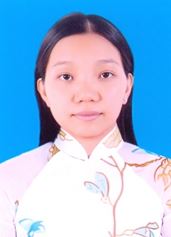
Name: PHAN
First name: KIEU DIEM
Nationality: Vietnamese
Sex: Female
Date of birth: 29/9/1983
Place of birth: Hau Giang province, Vietnam
Place of residence: Thanh Hoa commune, Phung Hiep District, Hau Giang Province, Vietnam
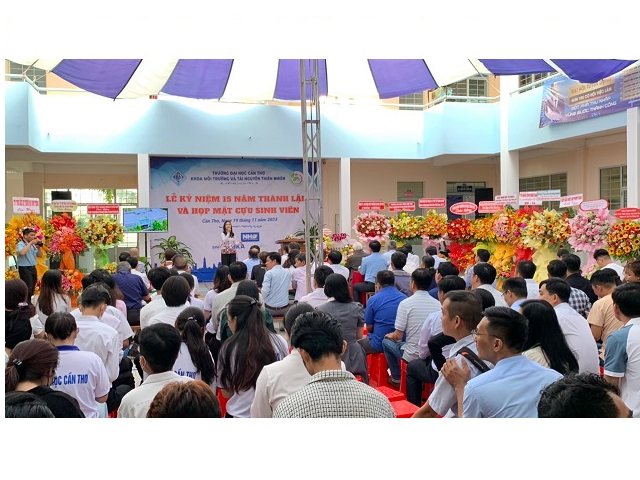
Current position: Lecturer and Researcher, College of Environment and Natural Resources, Cantho University, Vietnam
Email: pkdiem@ctu.edu.vn, pkdiemgis@yahoo.com
Phone: +66-96-7625-068
Education
2014: 2017 PhD: Environment Technology, The Joint Graduate School of Energy and Environment, King Mongkut's University of Technology Thonburi, Thailand
2010 Master Degree: Remote Sensing and Geographic Information System (GIS), Asian Institute of Technology, Thailand
2005 Bachelor Degree: Land Management, Cantho University, Vietnam
Honors
2014: 2017 PhD scholarships, King Mongkut's University of Technology Thonburi, Thailand
2010 Digital Globe and Wetlands Alliance research grant for master’s thesis
2009 A joint master research fellowship by Asian Institute of Technology and The Training and Research Improvement Grant of Cantho University for higher education
2001: 2005 Outstanding student academic grants by Cantho University, Viet Nam (Bachelor degree)
Research Interest
Forest health and ecosystem
Climate impact assessment on forest health
Coastal ecosystem and its environment
Research Experience
08/2014: Present Research assistant: Forest Carbon Change (FCC) project, The Joint Graduate School of Energy and Environment, King Mongkut’s University of Technology Thonburi, Thailand
- Impact of climate change on forest health in Thailand using MODIS imagery and literature review on VPM biosphere modeling
- Landsat TM5 and 8 preprocessing and interpretation for land use in Thailand region
1/2011: 12/2015 Researcher: Climate change affecting land use in the Mekong Delta: adaptation of rice-based cropping systems (CLUES), Cantho University, Vietnam
- GIS database updating
- Vulnerability assessment of land use types by flooding and salinity intrusion
1/2012: 12/2012 Project coordinator: Tending of Erosion and Accretion in Mekong Delta Estuary, Cantho University, Vietnam
- Interpretation of Landsat TM5 for monitoring the changes in coastal line and its ecosystem
12/2010: 12/2012 Data Analyst: The sustainable farming system of salinity soil in term of climate change in Ben Tre Province, Vietnam
- GIS analyst for data interpretation
1/2008: 12/2009 Research assistant: Assessing the fertile potential and obstacles factors on cultivated soil of rice and fruit trees in Hau Giang Province, Cantho University, Vietnam
- Conducting field survey and integration of socio-economic data
8/2005: 12/2009 Lab assistant: Geographic information systems and remote sensing laboratory, soil sciences and land management department, Cantho University, Vietnam
- Assisting student with lab work
Teaching Experience:
01/2011: Present Lecturer: Land management department, Cantho University, Vietnam
- Basics of geographic information systems
- Advance remote sensing
- Application of remote sensing and GIS in Urban Planning
01/2005: 12/2010 Assistant lecturer: Soil Sciences and Land Management Department, Cantho University, Vietnam
- Basic of Geographic Information Systems
- Basic of remote sensing
- Application of remote sensing and GIS in Urban Planning
Training Experience:
14/07/2015: 23/08/2015 Building resilience to climate change course I: Science, impact and vulnerability, University Network for Climate change and ecosystems change adaptations research (UN-CECAR), Chulalongkorn University, Thailand
27/07/2015: 05/08/2015 Building resilience to climate change course II: Approaches to adaptation, University Network for Climate change and ecosystems change adaptations research (UN-CECAR), Chulalongkorn University, Thailand
14/10/2014: 17/10/2014 Climate data analysis and vegetation monitoring using R, King Mongkut’s University of Technology Thonburi, Bangkok, Thailand
05/09/2013: 10/09/2013 RICEscape training course, Cantho University, Vietnam
12/11/2012: 16/11/2012 A practical approach for agent-based modeling, Cantho University, Vietnam
02/10/2012: 05/10/2012 ORYZA2000 crop modeling training, Cantho University, Vietnam
13/09/2012: 21/09/2012 Capacity building workshop of satellite remote sensing for Southeast Asian scientists, Center for Space and Remote Sensing Research, National Central University, Taiwan
Organization Experience:
21/07/2008: 26/07/2008 Instructor: GIS application in planting pest forecast, Cantho University, Vietnam
20/08/2007: 01/09/2007 Instructor: Mapinfo Software application in Mapping and Management of Thematic Maps, Cantho University, Vietnam
04/12/2006: 08/12/2006 Instructor: GPS and GIS application in Economic – Social and environmental resources in Hau Giang province, Cantho University, Vietnam
24/10/2005: 28/10/2005 Instructor: Application of remote sensing and GIS in mapping of land use change, Cantho University, Vietnam
List of publications
Phan Kieu Diem, Uday Pimple, Asamaporn Sitthi, Pariwate Varnakovida, Rungnapa Kaewthongrach, Amnat Chidthaisong. 2017. Response of tropical deciduous forest phenology to climate variation in Northern Thailand. 5th International Conference on Environmental Research and Technology (ICERT 2017), 23-25, August, 2017, Penang, Malaysia
Phan Kieu Diem, Amnat Chidthaisong, Uday Pimple, Asamaporn Sitthi, Pariwate Varnakovid, Rungnapa Kaewthongrach, Katsunori Tanaka. 2016.. Responses of Deciduous forest to El Niño in Thailand using remotely sensed technique. International Conference on Sustainable Energy and Environment on the theme of “Energy & Climate Change: Innovating for a Sustainable Future”, 28-30, November, 2016, Bangkok, Thailand
Phan Kieu Diem, Amnat Chidthaisong, Uday Pimple, Asamaporn Sitthi, Pariwate Varnakovida, Katsunori Tanaka, Rungnapa Kaewthongrach. 2016. Teak plantation phenology changes and its relationships to climate variability in Lampang Province, North of Thailand. Proceedings of the International Conference on Climate Change, Biodiversity and Ecosystem Services for the Sustainable Development Goals (SDGs): Policy and Practice, 27-29 June 2016, Cha-Am, Phetchaburi, Thailand
Phan Kieu Diem, Vo Quang Minh, Nguyen Thị Hong Diep. 2015. Assessment trend of inundation and salinity intrusion in coastal zone, Mekong Delta through climate change scenarios. The 36th Asian conference on Remote Sensing. October 19-23, 2015. Manila, Philippine.
Nguyen Thi Hong Diep, Vo Quang Minh, Phan Kieu Diem. 2015. Assessment of the vulnerable area of climate change impacts on coastal region of Mekong Delta using geographic information system technique. The 36th Asian conference on Remote Sensing. October 19-23, 2015. Manila, Philippine.
Vo Quang Minh, Nguyen Thi Ha Mi, Phan Kieu Diem, Le Quang Tri, Tran Thi Hien, Chu Thai Hoanh, To Phuc Tuong. Spatial and temporal changes of rice cropping season in Mekong Delta Vietnam by using MODIS imagery from 2000 to 2013. The 36th Asian conference on Remote Sensing. October 19-23, 2015. Manila, Philippine.
Phan Kieu Diem, Nguyen Thi Hong Diep, Pham thi Thuy Nga. 2015. Study on monitoring trend of Carbon Dioxide (CO2) emission in the Vietnamese Mekong Delta by using GOSAT satellite data. Journal of Science of Cantho University. ISSN: 1859-2333. Volume 39. Page 105-110
Phan Kieu Diem, Asamaporn Sitthi, Uday Pimple. 2015. Mapping Land cover dynamics in Nakhon Nayok province of Thailand. Suan Sunandha Science and Technology Journal. ISSN 2351-0889. Page. 1-5
Nguyen Thi Hong Diep, Vo Quang Minh, Phan Kieu Diem, Pham Quang Quyet. 2014. Monitoring the chaning of aquaculture areas in An Giang Province 2008 to 2012 using GIS and Remote Sensing. Journal of Science of Cantho University. ISSN: 1859-2333, Volume 30. Page. 78-83
Nguyen Thi Hong Diep, Vo Quang Minh, Phan Kieu Diem, Nguyen Van Tao. 2014. Evaluating the impact of climate change on land use change in the coastal line in Mekong Delta. Proceeding of National conference of GIS application from 28-29/11/2014 at Can Tho, Vietnam. ISBN: 978-604-924-039-3. Page. 88-94
Huynh Thi Thu Huong, Tran Thi Ngoc Trinh, Phan Kieu Diem. Mapping the current state of verdure in urban areas and monitoring its development in Ninh Kieu District, Can Tho City period 2006-2012. Proceeding of National conference of GIS application from 28-29/11/2014 at Can Tho, Vietnam. ISBN: 978-604-924-039-3. Page. 122-131
Nguyen Van Phuc, Nguyen Thi Ha Mi, Phan Kieu Diem, Vo Quang Minh, Le Quang Tri, Nguyen Xuan Hien. 2014. Evaluating the impact of climate change scenarios on current land use and land use planning in Hau Giang Province. Proceeding of National conference of GIS application from 28-29/11/2014 at Can Tho, Vietnam. ISBN: 978-604-924-039-3. Page. 845-854
Nguyen Quang Trung, Phan Kieu Diem, Vo Quang Minh. 2014. Assessing the rice crop patterns change in An Giang province from 2000 to 2013. Proceeding of Conference of Information Technology with climate change in developing Vietnam’s export agriculture production in Kien Giang on 29/09/2014. Page 68-70
Le Minh Hop, Tran Thi Hien, Vo Quang Minh, Nguyen Thi Hong Diep, Phan Kieu Diem. 2014. Application of MODIS imagery on monitoring the change of rice cropping season supported agriculture management in Mekong Delta. Proceeding of National conference of GIS application from 28-29/11/2014 at Can Tho, Vietnam. ISBN: 978-604-924-039-3. Page 169-180
Nguyen Quang Trung, Vo Quang Minh, Phan Kieu Diem. 2014. Evaluating the fluctuation of the rice crop patterns in An Giang province from 2000 to 2013. Proceeding of National conference of GIS application from 28-29/11/2014 at Can Tho, Vietnam. ISBN: 978-604-924-039-3. Page 41-49
Vo Quang Minh, Le Quang Tri, Phan Kieu Diem, Nguyen Xuan Hien. 2014 Application of GIS to identify the vulnerable areas under climate change impact in Mekong Delta. Proceeding of Conference of Information Technology with climate change in developing Vietnam’s export agriculture production in Kien Giang on 29/09/2014. Page 82-84
Phan Kieu Diem, Vo Quang Minh, Nguyen Thi Hong Diep, Diep Van Den. 2013. Monitoring the shoreline change in coastal area of Ca Mau and Bac Lieu province from 1995 to 2010 by using remote sensing and GIS. Journal of Science of Cantho University. ISSN: 1859-2333. Volume 26. Page: 35-43
Phan Kieu Diem, Vo Quang Minh, Nguyen Thi Hong Diep. 2013. Current erosion and accretion in Mekong Delta estuary. Proceeding of environmental, natural resources and climate change in Mekong Delta conference, Cantho University, Vietnam. Page: 433-442
Phan Kieu Diem, Vo Quang Minh, Nguyen Thi Hong Diep. 2013. Remote sensing for coastline detection in Mekong Delta estuary. Proceeding of environmental, natural resources and climate change in Mekong Delta conference, Cantho University, Vietnam. Page: 443-451
Phan Kieu Diem, Vo Quang Minh, Nguyen Thi Hong Diep, Duong Thanh Thoai. 2013. Monitoring the shoreline change Ngoc Hien district, Ca Mau Province from 1995 to 2010 by using remote sensing and GIS. Proceeding 9th International conference on Gi4DM 2013, Earth observation for disaster management. Hanoi, Vietnam from 9-11 December, 2013. ISBN: 978-604-913-173-8(2013) Trang: 1-10
Phan Kieu Diem, Vo Quang Minh, Nguyen Thi Hong Diep, Duong Thanh Thoai. 2013. Monitoring and assessing the shoreline change of the coastal in Ngoc Hien district, Ca Mau Province from 1995 to 2010 by using remote sensing and GIS. National conference of GIS application. ISBN: 978-604-924-039-3. Page: 402-409
Phan Kieu Diem, Nitin Kumar Tripathi, Vo Quang Minh. 2012. Application GIS and remote sensing for monitoring the changing of coral reef at Tam Hai commune, Nui Thanh district, Quang Nam province. International conference on geomatics for spatial infrastructure development in earth and Allied Sciences GIS-IDEAS 2012. Ho Chi Minh City, Vietnam 16-20 October 2012. Page: 181-186
Nguyen Thi Hong Diep, Phan Kieu Diem, Vo Quang Minh, Le Minh Hop, 2012. Monitoring the current state of coral reef and seagrass in Phu Quoc Island by using Landsat and Alos imagery. National conference of GIS application. No 225-2012/CXB/38-08/NN. Page 291-298
Phan Kieu Diem, Vo Quang Minh, Nitin Kumar Tripathi, Nguyen Thi Hong Diep. 2012. Developing the coral reef map in Tam Hai Ward, Nui Thanh District, Quang Nam Province by using Quickbird Image. National conference of GIS application. No 225-2012/CXB/38-08/NN. Page 168-173
Phan Kieu Diem, Nguyen Thi Hong Diep, Vo Quang Minh. 2010. Natuaral disaster in Mekong delta, Vietnam. Geoinformation technology for natural disaster management & rehabilitation conference, Chiang Mai, Thailand
Phan Kieu Diem, Nguyen Thi Hong Diep, Vo Quang Minh, 2008. Natuaral disaster in Mekong delta. Journal of Science, Cantho University
Vo Quang Minh, Phan Kieu Diem, Nguyen Thi Hong Diep, 2006. Initial method in spatial delineation of some chemical charateristics in ground water of Hau Giang province by GIS technique. Viet Nam Soil Science, Volume 28. Page 35-39.
LANGUAGES Fluent in English and Vietnamese (spoken and written)
- Can Tho University Hosts Kasetsart Students for Environmental Engineering Internship Program
- Sediment properties in flood-based farming systems in the Vietnamese upstream Mekong Delta
- Feasibility evaluation of using cattle manure for biogas production: A case study under household conditions in the Vietnamese Mekong Delta
- Awarding a Certificate of Appreciation of Can Tho University to Dr. Taro Izumi, Japan International Center for Agricultural Sciences (JIRCAS), Japan
- The 42nd Asian Conference on Remote Sensing
- Conference on “Industry 4.0 in Agriculture and Land Resources Exploitation Management”
- International Conference IFGTM 2021
- The 5th scientific conference “Environment, Natural Resources and Climate Change”
- The international conference “Multi-Disciplinary Approach in Environment Protection for Sustainable Development”
- Mr. Fujiwara Nobuyoshi and Dr. Minamikawa Kazunori from JIRCAS to visit CENRes from September 13th to 21st, 2018