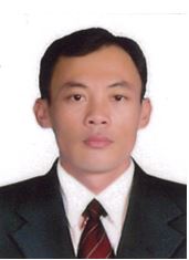
SCIENTIFIC CURRICULUM VITAE
- Personal details
|
Full name: Vo Quoc Tuan |
Gender (M/F): M |
|
Date of birth: 28-02-1978 |
|
|
Educational degree (PhD, MSc): PhD |
Year obtained: 2013 |
|
Title (Prof., Assoc. Prof., etc): |
Year confered: |
|
Position: Head of GIS and Remote Sensing Lab |
Year confered: 2013 |
|
Institution & Department: Department of Land Resources, College of Environment and Natural Resources, Can Tho University, Vietnam Address: 3/2 Street, Can Tho City, Vietnam Mobile phone: 84-913-604111 E-mail: vqtuan@ctu.edu.vn |
|
|
Home address: 263D/7, An Binh Ward, Ninh Kieu District, Can Tho City, Vietnam Tel.: |
|
II. Qualifications (training)
Years |
Academic institutions |
Major/Specialty |
Academic degree |
|
2013 |
German Aerospace Center, Germany |
Remote Sensing |
PhD |
|
2008 |
Seoul National University, South Korea, Department of Agricultural Economics and Rural Development, Regional Information Major |
Economics |
MSc |
|
2001 |
Can Tho University, Vietnam, College of Agriculture and Applied Biology, Department of Soil Science and Land Management |
Land Management |
BSc |
* Language (rating: A- Poor/ deficient; B- Fair; C- Sufficient; D- Fluent)
|
Language |
Reading |
Writing |
Speaking |
|
English |
C |
C |
C |
|
|
|
|
|
III. Professional working experience
Years (from ... to ...) |
Institution and address |
Position and Responsibilities |
|
06/2013 – Present |
Can Tho University, Vietnam, Lecturer and Researcher in Department of Land Resources. |
Research in the field of Remote sensing, Ecosystem service valuation and Environmental economics |
|
08/2009 – 05/2013 |
German Remote Sensing Data Center, DLR, Germany |
PhD researcher. Research in the field of economic evaluation of mangrove ecosystem services using combined approaches of remote sensing data and socio-economic data. |
|
03/2008 - 07/2008 |
Can Tho University, Vietnam, College of Agriculture and Applied Biology, Department of Soil Science and Land Management |
Researcher in the field of remote sensing and cadastral mapping; Supervision of undergraduate students in the field of remote sensing applications, GIS, land management, environment assessment and cadastral mapping |
|
02/2006 – 02/2008 |
Seoul National University, South Korea |
Department of Agricultural Economics and Rural Development, Regional Information Major; Master of Art in Economics. |
|
10/2001 – 02/2006 |
Can Tho University, Vietnam, College of Agriculture and Applied Biology, Department of Soil Science and Land Management |
Researcher and Teaching assistance in the field of GIS and Remote Sensing |
|
09/1997 – 09/2001 |
Can Tho University, Vietnam, College of Agriculture and Applied Biology, Department of Soil Science and Land Management |
Bachelor of Land Management. |
- Expertise and research interests
|
1. Research projects/programs participating or leading relevant to the field of study |
|||
|
Project/program title |
Duration (from … to …) |
Category (national, ministerial, institutional, Int'l collaborative) |
Position/role in the project (principal or member) |
|
Mangrove ecosystem services valuation-a combined approach of remote sensing and household survey analyses |
2013-2014 |
Int'l collaborative |
Principal |
|
Remote sensing-based Information and Insurance for Crops in Emerging economies (“RIICE”) |
2015-2017 |
Int'l collaborative |
Member |
|
|
2016-2017 |
|
|
|
Ecosystem-Based Coastal Spatial Planning Demonstration Project in Ca Mau province, Viet Nam |
|
Int'l collaborative |
Principal |
- List of publications (listed as reference format)
- a) Book chapters
- b) Articles in peer-reviewed journals
Hironori Arai, Ryo Yoshioka, Syunsuke Hanazawa, Vo Quang Minh, Vo Quoc Tuan, Tran Kim Tinh, Truong Quoc Phu, Chandra Shekhar Jha, Suraj Reddy Rodda, Vinay Kumar Dadhwal, Masayoshi Mano, and Kazuyuki Inubushi, 2016 Function of the methanogenic community in mangrove soils as influenced by the chemical properties of the hydrosphere. Soil Science and Plant Nutrition. Vol. 62, http://dx.doi.org/10.1080/00380768.2016.1165598
Tuan Quoc Vo, C. Kuenzer, N. Oppelt, 2015. How remote sensing supports mangrove ecosystem service valuation: A case study in Ca Mau province, Vietnam. Ecosystem Services. Volume 14, August 2015, Pages 67-75, ISSN 2212-0416, http://dx.doi.org/10.1016/j.ecoser.2015.04.007.
QT Vo., OPPELT, N., and C. KUENZER, 2013: Remote Sensing in Mapping Mangrove Ecosystems - An Object-based Approach Remote Sensing 5(1), 183-201. doi:10.3390/rs5010183
QT Vo, C Kuenzer, QM Vo, F Moder, N Oppelt, 2012: Review of valuation methods for mangrove ecosystem services. Ecological Indicators 23, 431-446. doi:10.1016/j.ecolind.2012.04.022
KUENZER, C., CAMPBELL, I., ROCH, M., LEINENKUGEL, L., VO QUOC, T., and S. DECH, 2012: Understanding the Impacts of Hydropower Development in the context of Upstream-Downstream Relations in the Mekong River Basin. Sustainability Science. http://dx.doi.org/10.1007/s11625-014-0275-3
J Huth, C Kuenzer, T Wehrmann, S Gebhardt, QT Vo, S Dech, 2012: Land cover and land use classification with TWOPAC: towards automated processing for pixel-and object-based image classification. Remote Sensing 4 (9), 2530-2553. doi:10.3390/rs4092530
Claudia Kuenzer, Andrea Bluemel, Steffen Gebhardt, Tuan Vo Quoc and S. Dech, 2011: Remote Sensing of Mangrove Ecosystems- A review. Remote Sensing 3 (5), 878-928. doi:10.3390/rs3050878
- Other information
- Research gate: (by 30-05-2017)
Score: 20.05; Citation: 586
- Reviewer for journals: Ecosystem services, Remote Sensing, Forest

